1 - Departure
From the entertainment room, cross the village in the direction of Champoly then walk along the cemetery to join the D44.
2 - Step 1
Cross it and take the tree-lined grassy path opposite for 1,2 kilometers.
3 - Step 2
After a tarmac crossing located about 50 meters from the restored wash house near the transformer, take a steep path to the right for 600 meters which leads to the quarry and the "Croix Chivet" which delimits two cantons and three towns: Saint-Romain-d ' Urfé, Champoly and Les Salles.
4 - Step 3
Continue to the right and always keep this path to reach "Chez Dambert".
5 - Step 4
Arrived there, at the crossroads turn right, follow the road for 200 meters. Take a path lined with stones on your right which will lead you to "Chaboutet", a hiking center. Continue your route to the "Barges".
6 - Step 5
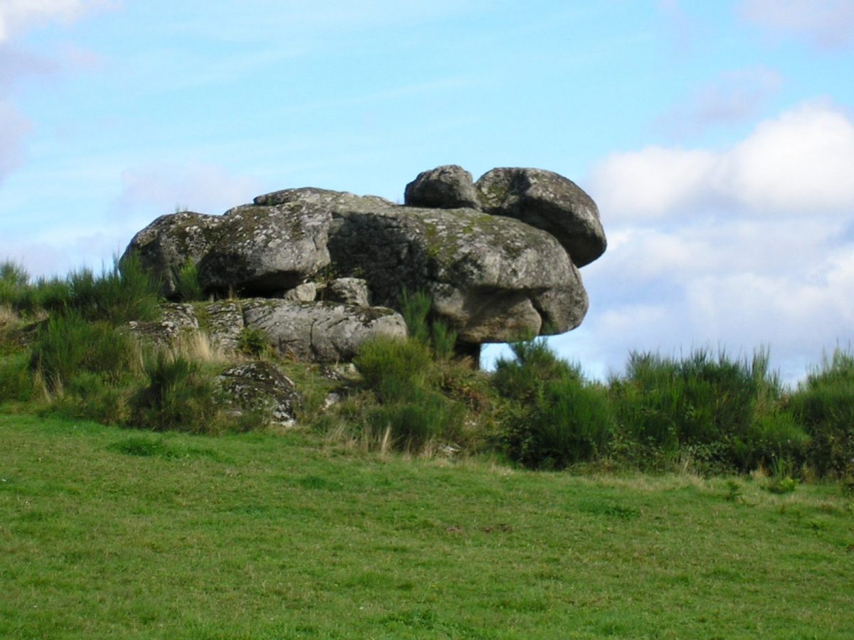
Continue on the tarmac path to the left, pass in front of the Tête de Tortue megalith and reach "Villeneuve". Take the 1st path on the right which runs alongside the houses, climb for about 60 meters and turn right again, a path leading to the "Croix du Pommier".
7 - Step 6
Go down to the left for 1,2 kilometers and turn right on the Goutte des près trail which leads to the "Grabillière".
8 - Step 7
At the cross, take the path on the left between the houses. At a new junction, take another left to come to the D1. Follow it for 150 meters to the right and turn left. Cross "Letra" and join the D44 on the right to the "Croix de tour".
9 - Step 8
Take the path to the right on the "Ménardie" then on the "Manissolle".
10 - Step 9
The path leads again to the D1, follow it to the left for 80 meters and take the path to the right, located in the bend in front of the cross, which descends on "Fican" and "Gaud".
11 - Step 10
In "Gaud", take the path above the cross then 200 meters further take the Gouttes path. This will take you to the "Caure".
12 - Step 11
Take the tarmac path to the right, descend to "Combe", turn right, pass in front of the "Moulin Baron" from which you can see all the wheels and millstones.
13 - Step 12
Follow the mill reach for 300 meters and continue straight on for 800 meters on the grassy path, overlooked by Noisetiers, which leads to the "Croix de la Lichère".
14 - Step 13
Turn left and go up to the church to get back to your starting point.