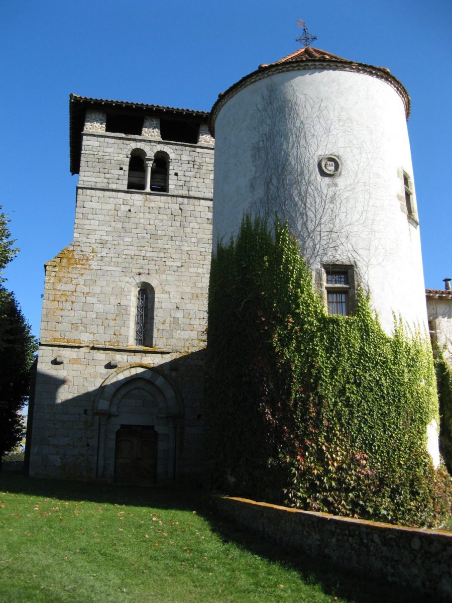
Here is a hike from the banks of the Aix to the heights of Nollieux which turns into a walk through history to discover the Commanderie de Verrières built by the Templars.

Itinerary to find in the topographical guide:
Topoguide PR Les Vals d'Aix and Isable ... on foot. Between Roannais and Forez. Ref P424

Your itinerary

Map List
Download
Download kml

1 - Departure

From the center of Saint-Germain-Laval, join the Notre Dame de Laval chapel by rue de la Génétine and rue de Bafiie. Go down on the left by the path to the small sanctuary on the banks of the Aix. Cross the bridge (XNUMXth century) on the left, continue by the path opposite, turn right and, after a valley, go up to the left.

2 - Step 1

Take the road to the left then climb the road to the right. It rises in the hamlet of Bruyère. Continue by the road after the hamlet, then fork onto the left path. At the top, turn right on the small road to reach the cross. Go up the left path. It crosses a coniferous forest.

3 - Step 2

In Maurand, take the road to the left, descend to the Virgin, pass to its right (panorama over the plain of Forez). Continue straight on to cross the D21 in Nollieux.

4 - Step 3

At the cross, continue straight and, at the intersection of the tracks, take the one on the left. he crosses a valley. Continue by the path to the left and reach the La Pala farm. Take the road on the left. At the crossroads, take the road opposite and join the Commanderie de Verrières on the left.

5 - Step 4

Take the path behind the cross, then go down to the left, walk along the pond and continue along the small road. She is heading towards Saint-Germain-Laval. Cut the D21, continue straight ahead, then take the D1 to cross the bridge over the Aix.

6 - Step 5

Just after the bridge, at the first house, use the path reserved for pedestrians and cyclists on the left. It leads to the Saint André church. Reach the starting point passing in front of the lapidary museum.